

Welcome! We’re continuing our sweaty summer slog through the desert southwest looking for similarities and differences with the Big Sioux Watershed. Statistics on the last several posts indicate that the number of readers has dropped off but I don’t know if it’s because of the content or the summer blahs? Hang in there! We’ve only got a couple more posts to go before we return to essays about the local archaeology and environmental science. When school starts in a few weeks, we’ll look at natural springs in the Good Earth/Blood Run area.
In this piece we’re going to explore a relatively new National Monument; it was founded in 2012 during the Obama administration. Don’t confuse this Chimney Rock National Monument with the Chimney Rock National Historic Landmark. That’s the one that I was familiar with, but it’s in the Panhandle of Nebraska. THIS Chimney Rock is in southern Colorado near the city of Pagosa Springs. It’s about 100 miles northeast of Chaco Canyon and it was an outpost of the Ancestral Puebloan culture centered in the canyon. The main themes for this post are access and alignments.
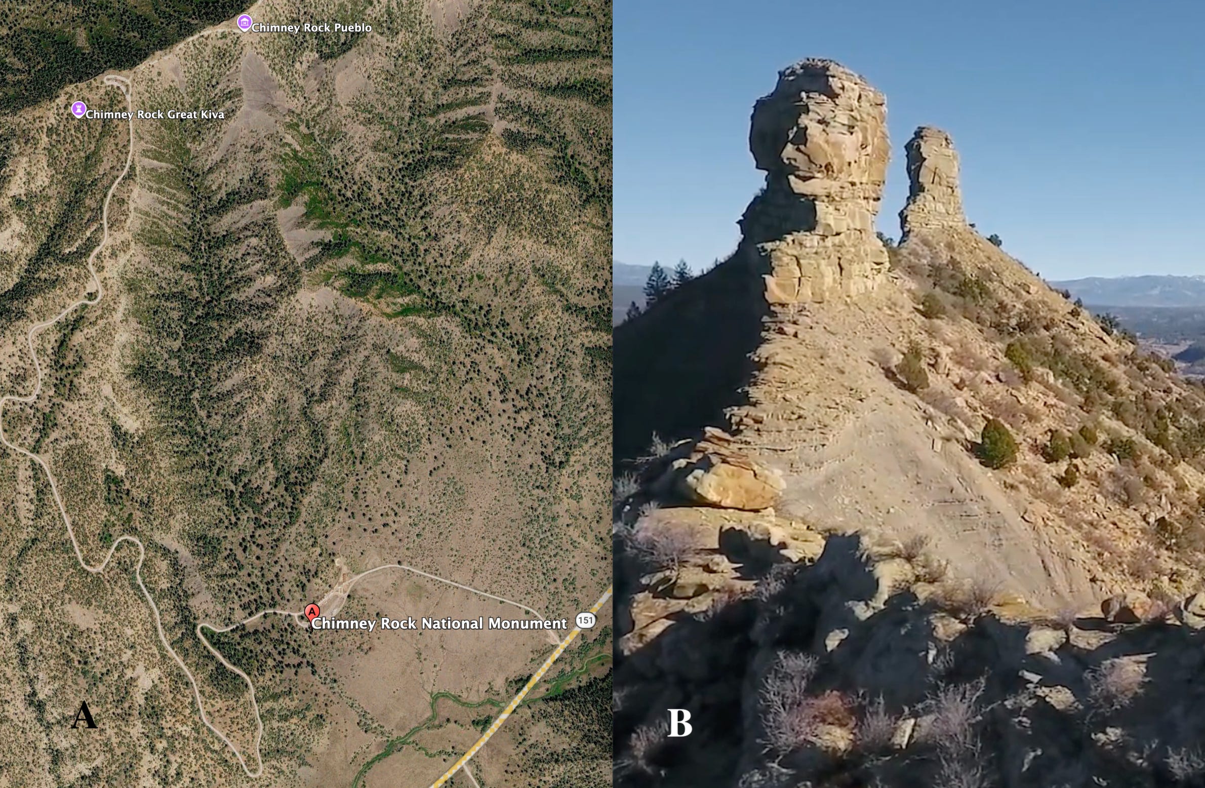
Figure 1----A) Roads to Chimney Rock. (Screen shot from Google Earth) B) The distinctive spires out along the ridge to the northeast. (Screen shot from drone footage that you can view here.)
Access to Chimney Rock was a lot different than Chaco Canyon. There’s a hard surface road to get to the visitor’s center and also on up the mesa to the trail head near Chimney Rock Great Kiva (Figure 1-A). But, then it’s a pretty rough hike (at least for octogenarians!) along the ridgeline to get out to Chimney Rock Pueblo. The pueblo is the closest that you can get. This is where you stand and look northeast out farther along the ridge to where the rock spires are actually located (Figure 1-B). The trails that we walked in the canyon were flat and smooth. But this Chimney Rock experience was worth the hike and climb.
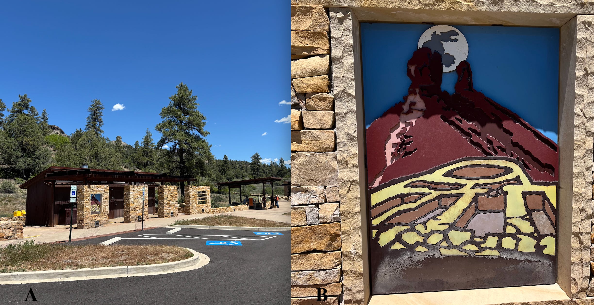
Figure 2----A) A portion of the Visitor’s Center. B) Artistic rendition of a full moon rising between the rock spires beyond the Chimney Rock Pueblo.
As one of the newest additions to our wealth of shared public lands, Chimney Rock National Monument has a look that’s different than the iconic old-fashioned “timber and field stone” visitors’ centers like Mesa Verde or Aztec Ruins. The new look is very minimalist and spartan (Figure 2-A) with no potable water, but it does have a gift shop! The land is owned by the US Forest Service and the site is managed by a private nonprofit entity. So, like the buildings, the administration of the monument is different than the traditional Federal arrangement. It’s basically a public-private partnership model that might have some useful applications in other places including the Big Sioux Watershed.
Like all of the other facilities that we’ve visited in the Four Corners area, Chimney Rock has some great explanations and exhibits. That includes a piece of art that depicts the alignments that are intrinsic to the site (Figure 2-B). Geology, astronomy, and archaeology all come together here to define the alignments. Usually, these disciplines are separate technical “silos”, but in this place they come together to define the alignments. The geology creates the sight markers; the astronomy cycles provide the show; and the archaeology demonstrates that the Ancestral Pueblo people were patient and sophisticated observers.
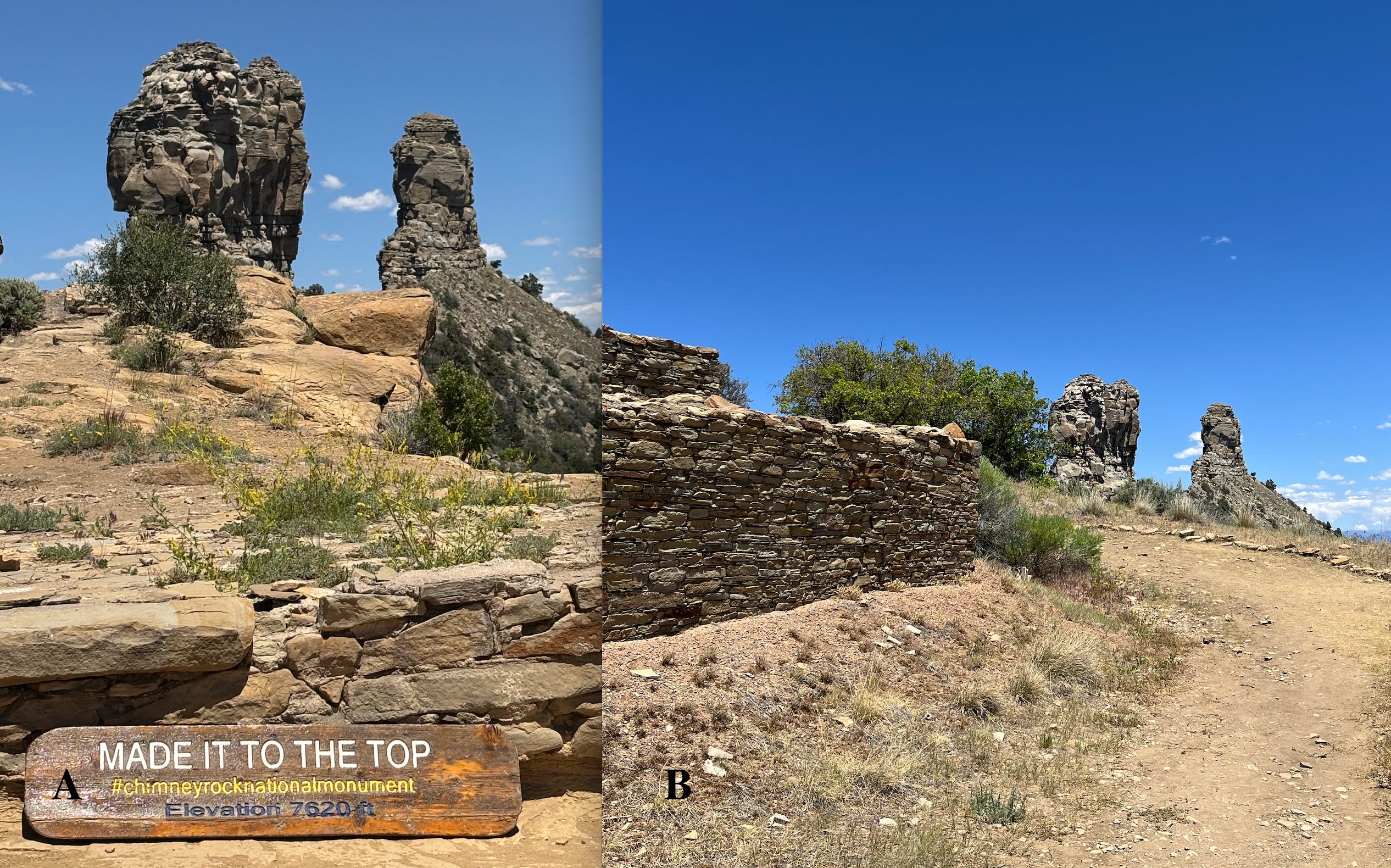
Figure 3----A) View of the rock spires from the pueblo. B) View of the sighting spires with a wall of the pueblo in the foreground.
Here’s the geology that makes the sighting tools (Figure 3-A). We could talk about the deposition of the marine sedimentary rock or about the erosion that produced the spires. However, that would be a distraction from the main message of this place. The main message is that every 18.6 years the full moon rises exactly between the twin spires. Then the moonrise position cycles away to the south from the perfect alignment and comes back north to mark successive Maximum Lunar Standstills (MLS). So, every 18.6 years the moon rises exactly between the spires, then it shifts south along the horizon line to a southern standstill position before coming back up and rising again in this “marked” location. That’s a pretty significant astronomical story, but there’s a human component that’s even more remarkable.
The Chimney Rock Pueblo constructed up here on this narrow ridge top (Figure 3-B) is believed to be an observatory built specifically to monitor and celebrate this MLS phenomenon. The wooden beams in the structure have been dated to 1018 AD, 1076 AD, and 1093 AD which are all times of Maximum Lunar Standstills as calculated from independent astronomical observations in other places. If you play with the math, there’s about four of the 18.6- year cycles between the earliest date and latest date. That suggests that people observed enough of the cycles to establish the timing and then during the construction of the building there were four separate standstill events to confirm and celebrate this recurring pattern. It would take a lot of lifetimes to get all of that done! Long-term observations like that would require multi-generational effort and institutional commitment. Plus, the walls are aligned with the slot between the rock spires (Figure 3-B) just like the buildings down in Chaco Canyon.
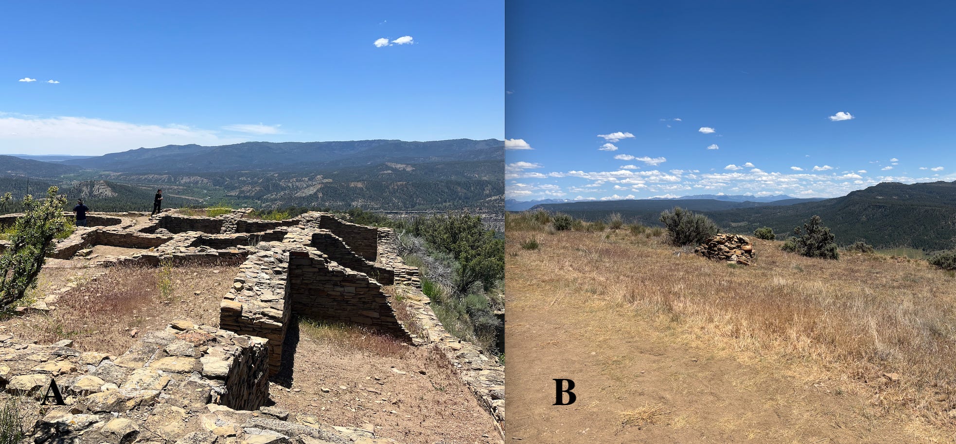
Figure 4----Two views to the southwest into the San Juan Basin.
When we stand in the pueblo and look northeast along the narrow rim, we see the iconic twin spires. But if we turn and look to the southwest (Figure 4-A), we’re looking toward the Chaco Canyon cultural complex. It’s speculated that in addition to be being an observatory, the pueblo was also a line-of-sight signaling station. Intermediate outposts would probably have helped to pass the messages along the 100 or so miles “as the crow flies” to Chaco Cayon using signal fires or reflected sunlight from shiny pieces of mica. Maybe ceremonies in the cultural center depended on messages about what was being observed at the Chimney Rock pueblo?
This is all speculation about the cultural resources, but the view (Figure 4-B) is also toward the center of the San Juan Basin. And the San Juan Basin has more than 16,000 archaeological sites, according to an AI inquiry. There are also 40,000 historical oil and gas wells in the part of the basin located in northwestern New Mexico and southwestern Colorado. About half of the current wells are active but there are also active coal and abandoned uranium mines in the basin. So, this is an epicenter for extracting natural resources.
Simple AI inquiries are great for pulling up statistics, but putting together a query about pollution associated with energy production is a lot more tricky. It turns out that there’s a cloud of escaped methane hanging over the basin that’s been documented by satellite observations. That information is found in the extensive Wikipedia article (curated information in Wikipedia is an important source for AI) on the San Juan Basin. And these questions don’t even come close to addressing the cultural impacts of coal and uranium mines. However, the problems associated with extractive economies are not limited to the desert southwest. We have our own issues up here in the Big Sioux Watershed.
Postscript: Protecting Pipestone National Monument
Warning: The next few paragraphs describe some opportunities to exert your rights and responsibilities as a concerned citizen. But, everybody is busy. You may not want to spend the time reading all this stuff and following up with credible action. Or maybe this is just the kind of activity that you’ve been looking for?
In the Big Sioux Watershed, Pipestone National Monument needs our help. An old, existing pipeline is being replace/rerouted in the vicinity of the site. Here’s a link to background info that includes the direct link to the Minnesota Public Utilities Commission.
At the national level, we’ve already talked about the proposed rule changes to Section 106 of the National Historic Preservation Act. Those proposed changes will effectively limit input from the local public about projects that will impact archaeological sites like Pipestone. Here’s a link that provides background on this threat and some suggestions for actions that you can take.
I hadn't heard about the pipeline at Pipestone. Such interesting travels this summer. Great photographs.